 Meadow Folk
Blue Ridge Parkway in Fall: Where the Color Peaks, by Week
By Travel Planner & Researcher · Updated October 21, 2026
The Blue Ridge Parkway is 469 miles long. Fall color moves along it from north to south and from high elevation down. That means the same drive gives you completely different color three weeks apart, which is the whole trick to timing it. The Parkway is open 24 hours a day, weather permitting, and the site is fee-free year-round with no entrance fee or pass required. Below is the order things turn, the overlooks worth stopping for, and a three-day loop that does not double back.
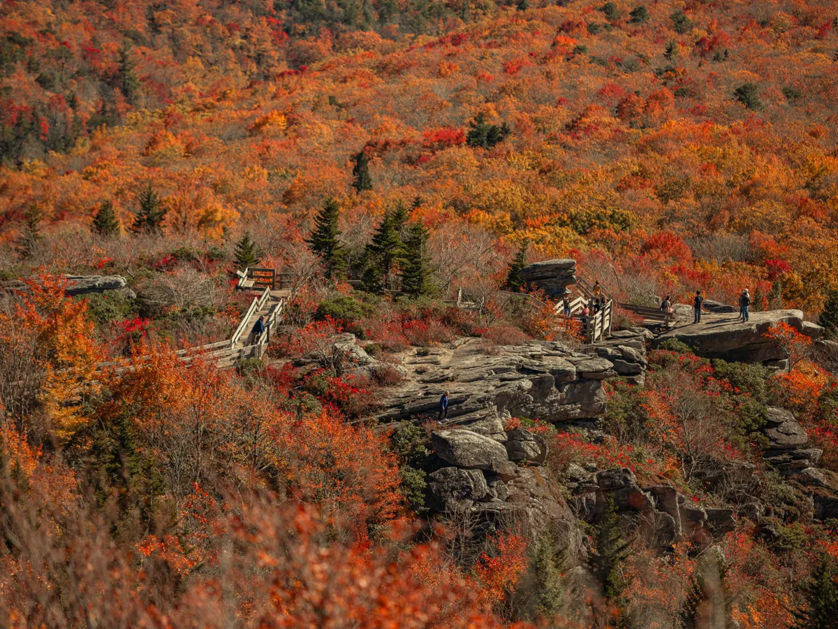
The stops, in order
1. Virginia high country, mileposts 170–216
- Photo spot:
- The elevated stretches above the Piedmont turn first. Shoot north from the overlooks here in the first half of October, when the ridges below are still mostly green and the contrast is the picture.
- Eat:
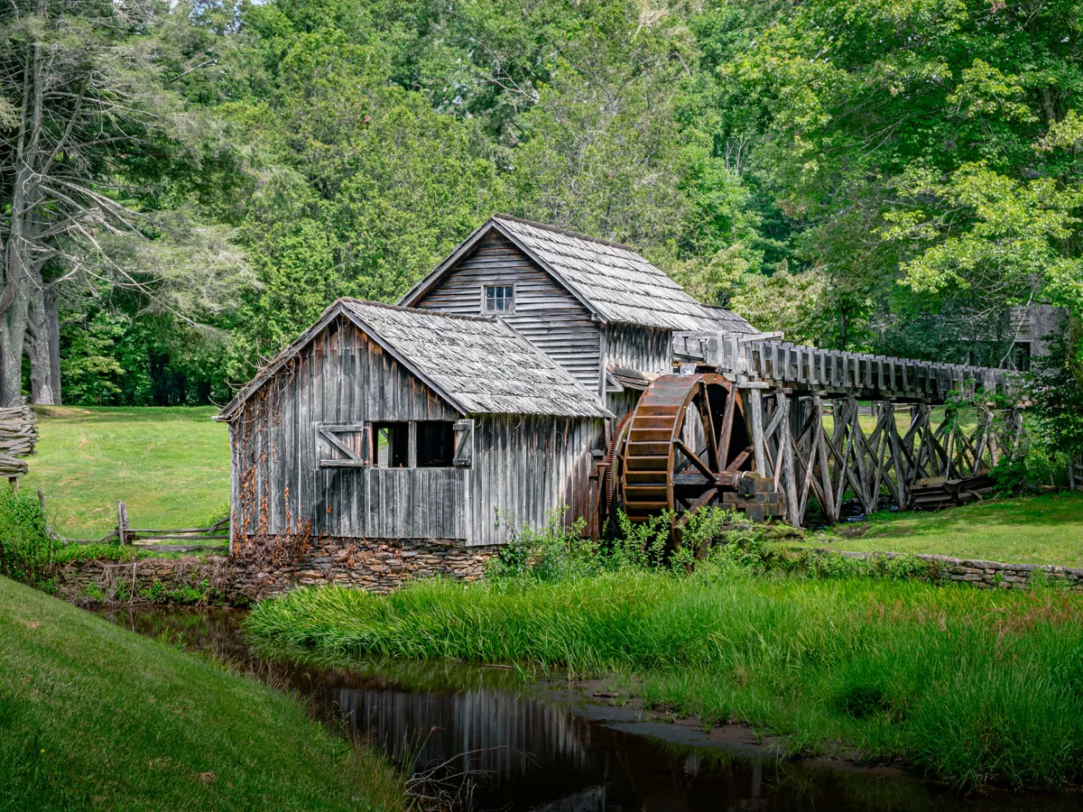
- Mabry Mill is at milepost 176 on the Blue Ridge Parkway. The small towns off the parkway are where the food is.
- Cost:
- No entrance fee.
- Note:
- The Mountain Industry Trail at Mabry Mill is a 0.5-mile easy trail with views of the historic buildings. This section peaks earliest — typically late September into mid-October.
2. Doughton Park, milepost 241
- Photo spot:
- The long meadow at Basin Creek overlook. Wide, open foreground with the ridges behind, and the color holds later here than further north.
- Eat:
- Blowing Rock or Sparta for a proper meal.
- Cost:
- Doughton Park is at milepost 241, and its 56-site picnic area and 135-site campground are open seasonally.
- Note:
- Peaks mid to late October.
3. Linn Cove Viaduct, milepost 304
- Photo spot:
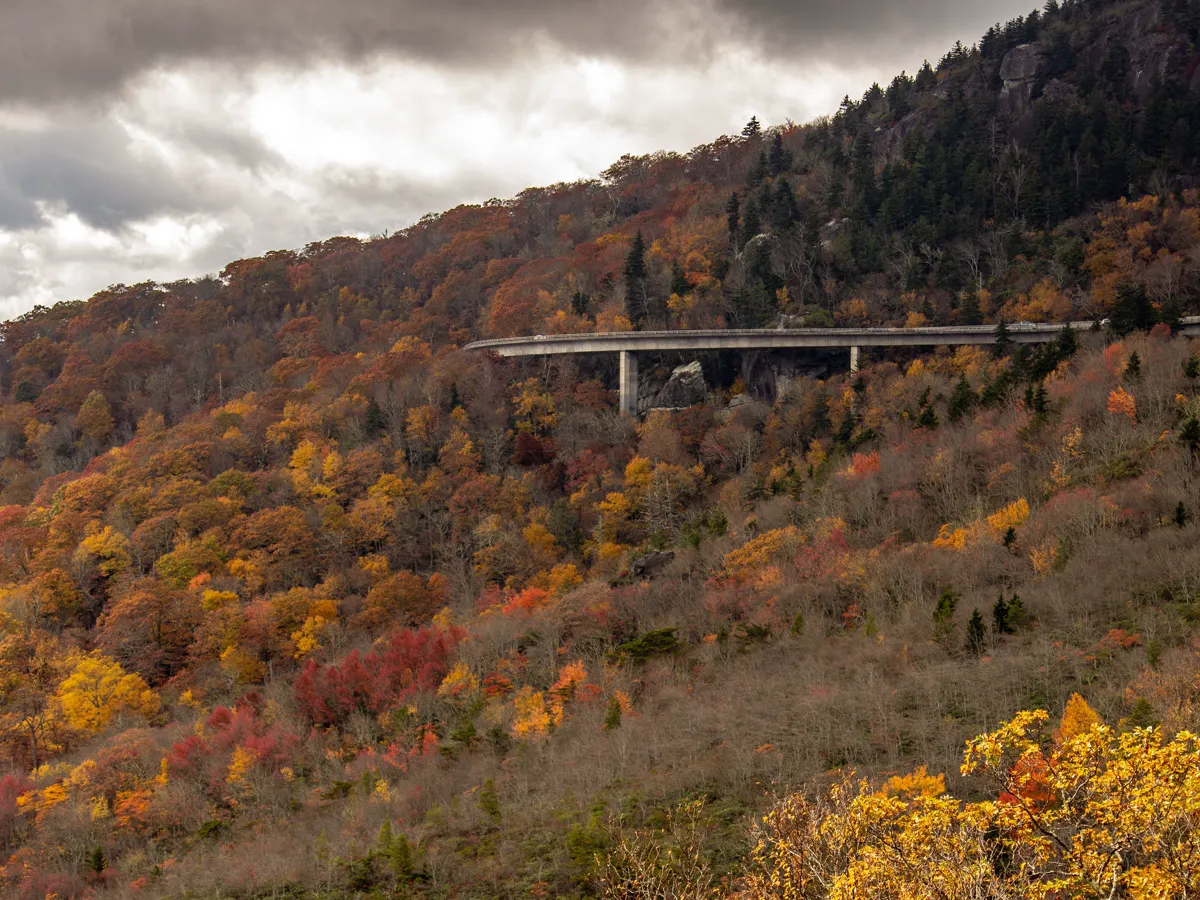
- The Linn Cove Viaduct is at milepost 304, is 1,234 feet long, and was built from 153 pre-cast concrete segments. This is the engineered shot of the Parkway, and it works in any season.
- Eat:
- Linville or Banner Elk, both a short drive off the parkway.
- Cost:
- No entrance fee. The visitor center at the viaduct has posted hours.
- Note:
- Color here peaks in the second half of October.
4. Grandfather Mountain View, milepost 306.6
- Photo spot:
- The Grandfather Mountain View overlook is at Blue Ridge Parkway milepost 306.6, and the mountain rises to an elevation of 5,939 feet. Shoot the ridgeline from the parkway side — the face is the subject and the color is the frame around it.
- Eat:
- Linville, ten minutes away.
- Cost:
- There is no charge to access the trails within Grandfather Mountain State Park from the parkway, at the Boone Fork Parking Area at milepost 299.9. The entrance to the Grandfather Mountain attraction is on Hwy 221S, 1.5 miles north of the parkway overlook, and it charges an entrance fee.
5. Graveyard Fields, milepost 418
- Photo spot:
- The valley floor with the river running through it. The Graveyard Fields Overlook is at milepost 418.8, and the loop trail there is 1.2 miles and rated easy overall, while the spur trails to the waterfalls are steep and add mileage.
- Eat:
- Brevard, about 30 minutes south.
- Cost:
- No entrance fee. The parking lot fills by mid-morning on October weekends.
- Note:
- Peaks mid to late October. The Graveyard Fields area is managed by Pisgah National Forest, and camping is not allowed in the area.
6. Devil's Courthouse, milepost 422
- Photo spot:
- Devil's Courthouse Overlook is at milepost 422 and rises above the surrounding spruce forest at 5,720 feet. A strenuous half-mile trail leads to the top of Devil's Courthouse. The view back along the ridge is the shot.
- Eat:
- Brevard or Asheville afterwards.
- Cost:
- No entrance fee. Parking is small and on the busy side of the road.
7. Waterrock Knob, milepost 451
- Photo spot:
- Waterrock Knob is at milepost 451.2 and, at 5,820 feet, is the Parkway's highest visitor center. Richland Balsam is the highest point on the Blue Ridge Parkway. Shoot west at sunset for the longest views on the whole route.
- Eat:
- Cherokee or Maggie Valley.
- Cost:
- No entrance fee. The Waterrock Knob visitor center is open seasonally.
- Note:
- Peaks late October into early November.
What it actually looks like
Where this starts
Questions people ask
When is peak color on the Blue Ridge Parkway?
It moves. The Virginia high country peaks late September into mid-October, the North Carolina sections around Asheville peak mid to late October, and the highest stops in the south can hold into early November. Driving north to south in late October is the safest single bet.
How long does the whole parkway take?
The Blue Ridge Parkway is 469 miles long. That is not a one-day drive. Three days, with a base in the middle, is what actually lets you shoot the overlooks at a decent hour.
Are there fees on the parkway?
The Parkway is open 24 hours a day, weather permitting, and the site is fee-free year-round with no entrance fee or pass required. Most picnic areas, campgrounds and visitor centers on the Parkway close from the beginning of November until early May. Check the one you want before you build a stop around it.
What is the one stop I should not skip?
Linn Cove Viaduct. The Linn Cove Viaduct is at milepost 304, is 1,234 feet long, and was built from 153 pre-cast concrete segments. It photographs at any hour, and it gives you a subject on the days when the color is flat and grey.
Where these facts come from
- National Park Service · Blue Ridge Parkway · last verified October 21, 2026
- National Park Service · Blue Ridge Parkway basic information · last verified October 21, 2026
- National Park Service · Mabry Mill · last verified October 21, 2026
- National Park Service · Doughton Park · last verified October 21, 2026
- National Park Service · Linn Cove Viaduct · last verified October 21, 2026
- National Park Service · Grandfather Mountain View · last verified October 21, 2026
- National Park Service · Graveyard Fields · last verified October 21, 2026
- National Park Service · Devil's Courthouse Overlook · last verified October 21, 2026
- National Park Service · Waterrock Knob · last verified October 21, 2026
Hours, fees and road status change without notice, so check the official page before you drive.